| U.S. 90 East
|
|---|

| Eastbound within the corporate limit of Pass Christian. U.S. 90 is quite scenic through both Pass Christian and Long Beach. This location is also the site of the second strongest hurricane to ever make landfall within the continental United States. September of 1969 saw this area buffeted with category 5 strength winds associated with the devastating Hurricane Camille. A gift shop along U.S. 90 offers is named after the hurricane through Pass Christian. Photo taken 06/21/01. |

| Just south of downtown Gulfport, is this intersection on U.S. 90 eastbound with U.S. 49 north. This is the southern terminus of the two-state U.S. route, as it receives a brunt of Gulfport related local traffic while also serving Gulfport Municipal Airport. The route is an important evacuation route for the area during hurricane season, and carries four lanes northward to Hattiesburg and Jackson. Photo taken 11/00. |

| Continuing eastbound on U.S. 90 within Gulfport, is this intersection with Hewes Avenue. Traffic turning left can access the Gulfport Municipal Airport without having to deal with the stop and go of U.S. 49 to the west. Note that the traffic lights, even with being location in hurricane country, are support by span wires instead of mast arms. Photo taken 06/21/01. |

| DeBuys Road marks the boundary between Biloxi and Gulfport from the Back Bay of Biloxi to the Gulf of Mexico shore. Note the limited beachfront separating U.S. 90 from the actual gulf. The sand is white overall, but the gulf itself is fairly shallow and loaded with clay. Photo taken 06/21/01. |
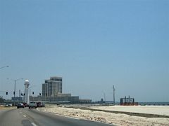 |
Approaching the casino district of Biloxi along U.S. 90 (Beach Boulevard) eastbound. In the distance of the Biloxi Lighthouse and signalized intersection with Porter Avenue. The level of destruction wrought on Biloxi from Hurricane Katrina on August 29, 2005 was catastrophic. The massive storm surge washed away all but the largest casinos from the beaches of Mississippi Sound. Buildings along U.S. 90 westbound did not fare much better. Photo taken 06/10/06. |
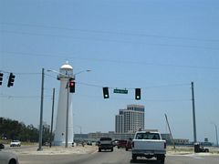 |
Temporary span-wire supported signals line U.S. 90 (Beach Boulevard) all along the Mississippi Sound water front through Biloxi. A set governs the intersection with Porter Avenue at the Biloxi Lighthouse. There used to be a large souvenir store to the right along the beach loop, but all of that was cleared away by the storm. Porter Avenue travels north from Beach Boulevard to Division Street and the East Gate of Keesler Air Force Base. Photo taken 06/10/06. |

| A pre-Hurricane Katrina look at the forthcoming split of Interstate 110 & Mississippi 15 north from U.S. 90 (Beach Boulevard) east. Note the lush trees along westbound and casino pier over Mississippi Sound. Photo taken 09/16/00.
|
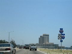 |
Naturally the signs were destroyed by the storm surge, so here are their replacements. Lush trees along the waterfront were wind raked and left in a very ragged state. The Beau Rivage Casino high rise and parking garage ahead suffered some damage but were reopened by Summer of 2006. Otherwise a trumpet interchange joins U.S. 90 with Interstate 110 & Mississippi 15, a north-south freeway linking Beach Boulevard and Interstate 10. Photo taken 06/10/06. |

| Another pre-Hurricane Katrina look at the Interstate 110 & Mississippi 15 northbound ramp departure from U.S. 90 (Beach Boulevard) eastbound. The northbound ramp glides over the Mississippi Sound beach and water before making the turn onto the freeway viaduct to D'Iberville. Interstate 110 & Mississippi 15 provide a high-speed route to D'Iberville and Interstate 10 to the north of the Back Bay of Biloxi. Photo taken 09/16/00. |
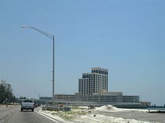 |
Looking at the elevated trumpet interchange between U.S. 90 and Interstate 110 & Mississippi 15. Interstate 110 & Mississippi 15 travel a viaduct north to the Back Bay of Biloxi draw bridge. The first northbound off-ramp join the freeway with Auto Mall Parkway in D'Iberville. A high-rise apartment building lies just west of the interchange along Beach Boulevard westbound. This structure remained abandoned by Summer of 2006. Photo taken 06/10/06. |
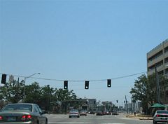 |
An army of temporary traffic lights govern the intersections through the casino district of Biloxi as the original mast arm signals were knocked over and mangled into a state of disrepair. The replacement signals were not sequenced and made the drive along U.S. 90 a lengthy one. Pictured here is the signal at the Beau Rivage parking garage entrance just east of Interstate 110. Photo taken 06/10/06. |
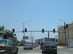 |
Reynoir Street ties into U.S. 90 (Beach Boulevard) from Martin Luther King Boulevard at the Beau Rivage Casino high rise. One of the only surviving sets of mast arms remains in use here. All of the internally lit street signs were smashed by Hurricane Katrina however. Use Reynoir Street north to Howard Avenue and downtown Biloxi. Photo taken 06/10/06. |
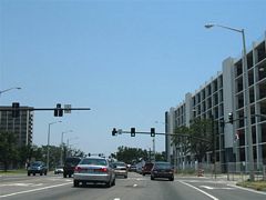 |
Eastbound U.S. 90 at Lameuse Street. The casinos and casino related structures were the only ones being rebuilt at the time of this photograph. Virtually all of the dwellings located along U.S. 90 were destroyed. Photo taken 06/10/06. |
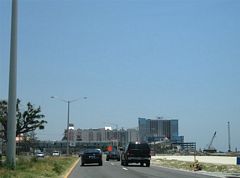 |
A wide swath of sandy beach was virtually empty between Holley and Oak Streets along U.S. 90 eastbound. Casinos along the Oak to Myrtle Street stretch suffered heavy damage. The building south of Pine Street was demolished and the one next to it succumbing to the same fate at the time of this photograph. Photo taken 06/10/06. |
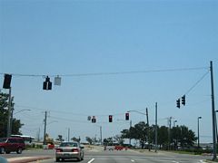 |
Travelers along U.S. 90 east could proceed no further than Myrtle Street in Biloxi. The approach to the Biloxi Bay bridge was closed as there is no bridge to cross. The bridge draw-span was left in the upright position to allow vessels unimpeded passage to Mississippi Sound. Demolition of the old bridge remnants will allow for a new span to Ocean Springs by 2007 or 2008. Photo taken 06/10/06. |

| A rare Interstate 10 Mississippi trailblazer, posted on U.S. 90 eastbound at the Van Cleave Road intersection. The road intersects with Interstate 10 at Exit 61 while U.S. 90 continues through central Gautier towards the mouth of the Pascagoula River and the city of Pascagoula. Photo taken 08/20/01.
|
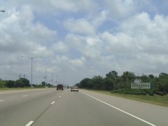 |
U.S. 90 travels a six-lane causeway between the east and west branches of the Pascagoula River. A welcome sign resides along the stretch for the city limits of Pascagoula. Photo taken 05/29/04. |
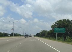 |
The right-hand lane becomes exit only for the Litton Road trumpet interchange. Litton Road travels south from U.S. 90 to Pascagoula Naval Station and the Northrop Grumman Ship Systems facilities in southwest Pascagoula. Photo taken 05/29/04. |
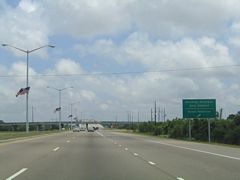 |
Drivers bound for Litton Road south and Pascagoula Naval Station depart U.S. 90 eastbound ahead of the East Pascagoula River high level bridge. Litton Road and USS Vicksburg Way comprise unsigned Mississippi 617 between U.S. 90 and the Naval Station on the Gulf of Mexico. Photo taken 05/29/04. |
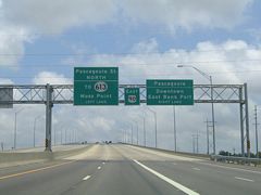 |
Sign bridge posted at the eastbound beginning of the East Pascagoula River high-level bridge along U.S. 90. U.S. 90 enters the heart of Pascagoula east of the span and intersects Pascagoula Street. Photo taken 05/29/04. |

| Construction of the high level bridge over the Pascagoula River between Gautier (pop. 11,681) and Pascagoula (pop. 26,200). The high level bridge opened to traffic in 2002 to replace the draw span pictured here. Due to the location of shipbuilding facilities, large vessels often
navigate through this waterway. Thus the four-lane drawbridge caused delays due to the time it took to open and close the draw span. Therefore the bridge replaced the current infrastructure with a new eight-lane facility. Photo taken 08/20/01.
|
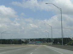 |
Descending from the crest of the span into Pascagoula on U.S. 90 east. The U.S. route travels Denny Avenue through the commercial district of the city. Photo taken 05/29/04. |
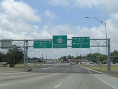 |
Traffic to Mississippi 613 (Telephone Road) northbound should turn onto Helen Street northbound for the one block connection to Telephone Road. Telephone Road flows southbound only between Helen Street and U.S. 90. Pascagoula Street otherwise intersects Denny Avenue just northwest of downtown and the East Port facilities along the Pascagoula River. Photo taken 05/29/04. |
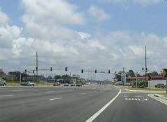 |
Modern mast-arm signal assemblies govern the intersection of U.S. 90 (Denny Avenue) with Pascagoula Street. Pascagoula Street travels north to River Road and Griffin Street in Moss Point (pop. 15,851). South of U.S. 90, Pascagoula Street intersects Magnolia Street for access to the East Bank port facilities nearby. Photo taken 05/29/04. |
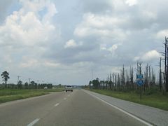 |
U.S. 90 departs the city of Pascagoula en route to Grand Bay, Alabama from Mississippi 63 & 611 (Industrial Road). The four-lane highway increases in speed to 65 mph on the way to Franklin Creek Road and its interchange with Interstate 10 (Exit 75). Photo taken 05/29/04. |
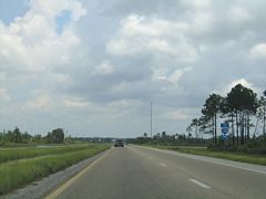 |
Approaching Franklin Creek Road on U.S. 90 eastbound. Franklin Creek Road stems northward from U.S. 90 as a four-lane divided highway to a diamond interchange with Interstate 10. Interstate 10 and U.S. 90 both cross the Alabama state line nearby. Photo taken 05/29/04. |
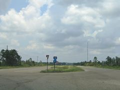 |
Interstate 10 trailblazer posted for Franklin Creek Road northbound. The interchange with Interstate 10 is visible to the north from U.S. 90. Franklin Creek Road otherwise continues north under the freeway to Independence Road and Forest Lake Road. Forest Lake Road ties into Old Pascagoula Road in Mobile County, Alabama. Photo taken 05/29/04. |

| U.S. 90 reduces to a rural two lane highway just ahead of the Alabama state line near Grand Bay. Photo taken 12/17/02.
|
Page Updated July 10, 2006.
