U.S. Highway 1 Southbound - Georgia to Monroe County

| Southbound U.S. 1 meets Florida 9 (Unity Boulevard/SW 27th Avenue) here. A Metrorail Station is visible in the background to the right. Florida 9 travels north through Miami, then angles northeast to join Interstate 95 at the Golden Glades Interchange. Photo taken 12/28/03. |

| Florida 959 (Red Road) acts as the boundary between the city of Coral Gables and South Miami. As U.S. 1 (Florida 5/Dixie Highway) travels southwest, it leaves Coral Gables (home to the University of Miami) and enters South Miami. Photo taken 12/28/03. |

| Florida 986 follows SW 72nd Street (Sunset Drive) east-west from South Miami west to Glenvar Heights and Sunset. This intersection is located in Sunset Place Mall. Photo taken 12/28/03. |

| After passing through Coral Gables and South Miami, U.S. 1 approaches Florida 878, the Snapper Creek Expressway. Florida 878 is a fairly short freeway route that connects U.S. 1 to Florida 874, the Don Shula Expressway. Use Florida 878 west to Florida 874 southwest to Florida's Turnpike to bypass U.S. 1 between Pinecrest and Homestead. Photo taken 12/30/03. |

| Southbound U.S. 1 reaches the turnoff to westbound Florida 878, the Snapper Creek Expressway. This freeway is so named because it parallels Snapper Creek for the entire length of the freeway. Although the shield used by the Miami-Dade Expressway (MDX) Authority looks like a toll shield, Florida 878 is not a toll road. However, it connects to the tolled Florida 874 and Florida's Turnpike System to the southwest. Photo taken 12/30/03. |

| The overpass ahead carries southbound Florida's Turnpike over U.S. 1; vehicles on that ramp will merge onto U.S. 1 southbound, signaling the end of the turnpike in Florida City. Photo taken 12/28/03. |

| A left turn connects southbound U.S. 1 with northbound Florida's Turnpike (Florida 821). Use the turnpike north to reach the Miami metropolitan area (it is much faster than using northbound U.S. 1. Photo taken 12/28/03. |

| The END shield for the Homestead Extension of Florida's Turnpike (secret Florida 821) is visible from southbound U.S. 1 as the highway enters Florida City. Photo taken 12/28/03. |

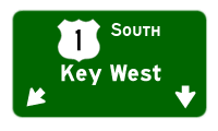
| This overhead sign advises motorists to continue straight ahead to Key West via U.S. 1; a left turn on Palm Drive leads to Biscayne National Park and a right turn on Florida 9336/Palm Drive leads to Everglades National Park via Ingraham Highway. Photo taken 05/06/06. |

| Southbound U.S. 1 reaches Florida 9336/Palm Drive/SW 344th Street; the highway is only a state road to the west. To the east, it is locally maintained. Photo taken 05/06/06. |

| Three quarters of a mile south of Florida 9336 (Palm Drive) is the south end of Florida 997 (Krome Avenue). Florida 997 represents historic Florida 27 between Florida City and U.S. 27 near the Broward County line. The state road primarily stays west of the heavily developed suburbs of Miami, straddling the Florida Everglades in the process. Florida 27 was renumbered to 997 to reduce confusion with U.S. 27 leading southeast into Miami. Photo taken 03/25/06. |

| A Florida Keys gateway variable message sign, so to speak, lies at the Florida 997 (Krome Avenue) intersection south of the Florida City line. Photo taken 03/25/06. |
 |
Beyond the Florida 997 intersection, U.S. 1 approaches Card Sound Road, which offers an alternate route to the Florida Keys via a locally maintained bridge over Card Sound. This would be a logical extension of Florida 997, but it is not signed (and Miami Dade County seemingly has few if any county-signed routes). The bridge itself carries a $1.00 toll for all passenger vehicles. Photo taken 05/06/06. |
 |
After passing through some fast food and strip mall areas, U.S. 1 finally emerges from the clutter to resume south through the mostly rural and agricultural lands south of Florida City. The highway is generally four lanes divided, with several two-lane stretches remaining. Photo taken 05/06/06. |
 |
123 miles to go on U.S. 1 southbound as it progresses southward from Florida City to Key Largo. Photo taken 05/06/06. |
 |
For the most part, U.S. 1 consists of just a two-lane highway between Florida City and Key Largo. Passing lanes exist between the Card Sound Road intersection and the Jewfish Creek draw bridge. Photo taken 05/06/06. |
 |
A sign advises motorists of the risks of aggressive driving and passing along the narrow U.S. 1 through the Florida Keys. Because of the risk of head-on collisions, the state is undertaking a $148-million project to widen the highway enough for the installation of jersey barrier medians between the Glades Canal crossing and Key Largo. Photo taken 05/06/06. |
Page Updated April 28, 2008


